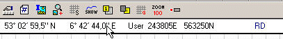
If you have done as I told you in part 1 of the "How to use Ozi Explorer with Dutch topographic maps." you have the map on screen with the rectangular grid and have positions in Easting and Northing. (I repeat again: do not look at the (also) shown position in degrees):
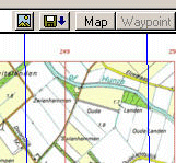
Remember: you have always to do two things: setting the position representation and setting the map datum. To start with the map datum. It should be (if you followed my advice) RD (or Rijksdriehoeksmeting). Now you change this by clicking the button 'Select display Datum':
A list will popup showing you many map datums. Take your pick: WGS84:
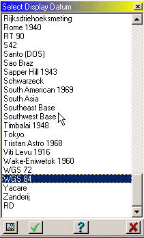
Then click the 'Accept the Selected Datum' button (the green finch) and you will see the position-numbers display change the 'RD' to 'WGS84' and the grey lines of the 'Other Grid' will shift a bit.
Now we have to get the degrees grid instead of the rectangulair RD-grid. We go to the button 'Grid Line Setup'. If you have no button for this: look in the menu 'Map' for the item 'Grid Line Setup'. You will have a box on screen now:
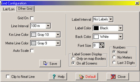
and we switch off the 'Grid on' from the 'Other Grid'. Now we can switch to the 'Lat/Lon' grid (grid with degrees!) and activate this one:
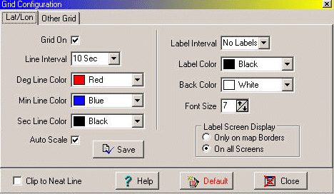
Do not forget to set the spacing of this grid: 'Line Interval 10 Sec' is a good one for the scale the topo-maps are on. Here is a picture of the result:
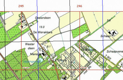
You will see that the new lines will not lineup nicely with the RD-grid.
Warning!
When you leave Ozi Explorer the map in use will keep its attributes for the next time you use it. So: a map that you have used for WGS84 will have a map-datum of WGS84 the next time you access it. This can lead to confusion (see part 1 of this Ozi-Help story).